Spring Creek
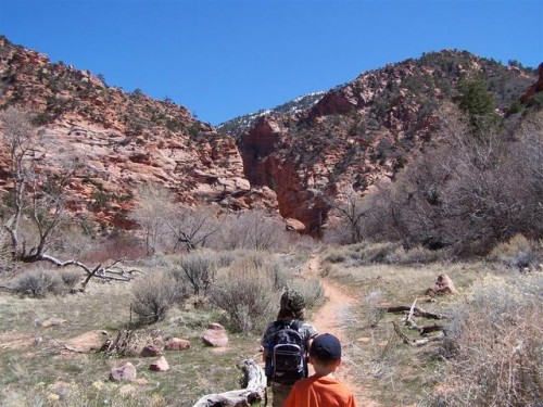
Not far from Cedar City, about a 1 mile south of Kanarraville, Spring Creek exits the Hurricane Cliffs. Just before the south edge of this town, a dirt track leaves the main road to the east, curves south and follows beneath the cliffs to the canyon mouth, a point identifiable from a distance by a neat V-shaped gap in the otherwise continuous straight cliffs. The whole of Spring Creek Canyon is a Wilderness Study Area. A rougher track heads up the valley aways, including several stream crossings, to the point where it narrows.

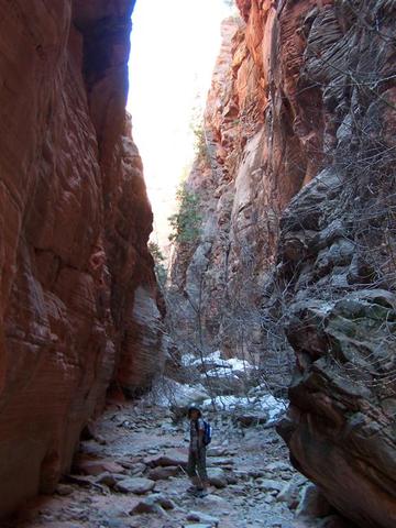
The narrows of Spring Creek have plenty of footprints, and a clear path runs through the lower section so it seems to be quite well known. It offers a good half day hike, along a canyon which is deep, secluded and pretty, just not especially narrow, unless you go way beyond the actual trail. We kept going even though it did get really rough terrain, and lots of rocks to climb over. There was a lot of snow in parts, and we had to cross over some “snow bridges” which was a little harrowing. Scott even sank in on a couple of parts, but thankfully, wasn’t too far down. We did manage to come across a part of the canyon that was literally arms length wide. Scott could almost touch from canyon wall to canyon wall. Brittany and Cole had such a fun time climbing in and out of little windows they’d find, and up and over logs and rocks. This was our first experience with a “slot canyon”, and now we want to go explore more, like the Zion Narrows in Zion National Park. We did about 6 miles of hiking on Saturday, and we all had a fun time.
To see pictures of Spring Creek Canyon, click here!!
About The Trail: (but we went far beyond the description below)

The trail winds up the canyon for 1.5 miles, mostly on the southwest side of the streamway, while above the rocks change to sedimentary – several volcanic dikes and faults mark the changeover, initially to jagged, upturned strata then sheer, deep red Navajo sandstone around the end of the track where the narrows begin. By now the cliffs tower 750 feet above the valley floor, rising to a jumbled array of angled, eroded peaks.
The stream fades away once the canyon proper starts, replaced by dry sand, stones and boulders, still with trees and bushes growing at the sides though other places have just bare rock. The canyon is never less than 10 feet wide but has lengthy narrow passageways, deep and quite shady. It twists and turns, sometimes by 90° and has only minor dryfalls and chokestones, so walking is always easy. This section has various small side drainages, the last of which is reached after about 40 minutes hiking, then the canyon becomes straight, wider at the base and more overgrown, with sandbanks at either side. The cliffs are now even more sheer and the streamway is soon filled by a mass of fallen trees, branches and large boulders. It later splits into two branches, each having a few narrow parts though both gain elevation quickly and remain quite overgrown. The hike to this point takes around 2 hours.
That trip was a lot of fun, I must say. Best part was the few people we came across, the hiking on Sunday had many more people.